Drove the rest of the way into Eugene this morning. My next load doesn't load until tomorrow morning. On the way to Eugene went down another cool road. Here is a small video of the scenery along that road:
Stopped for the rest of the day at the TA truck stop in Eugene.

Thursday, February 10, 2011
Wednesday, February 9, 2011
Wednesday, February 9, 2011
Took a back road up to Lakeview, Oregon where I was delivering. OR-140. It was a narrow two lane road that twisted and winded up and down a lot. Came over one mountain and at the top the sign said "8% Downgrade Next 6 Miles Last Warning". That road was really cool!! As I topped the mountain and saw what the sign was warning me about. I smiled a big smile. The view was gorgeous but the road was even better. Light dusting of snow on the road and 1500 foot drop off straight down and no guard rail! Twisty and turney road too. And it was every bit of an 8% grade. I loved it!! Here are a couple photos I took about 1/4 the way down.


Here are a few more photos of the same road but about 50 or so miles from the above photos.


Delivered in Lakeview, Oregon then headed toward Eugene. On the way I passed OR-140 where I came off it. There was a sign that restricted semi trucks to 60 feet in length on that road. Didn't see one coming from the other direction. I am at least 75 feet long. Oh well, at least I didn't get caught!! It was a great road to drive.
Stopped for the night in a little town in the middle of nowhere, La Pine, Oregon. There is a truck stop there. Didn't have enough hours left to make it to Eugene.
Tuesday, February 8, 2011
Tuesday Afternoon, February 8, 2011
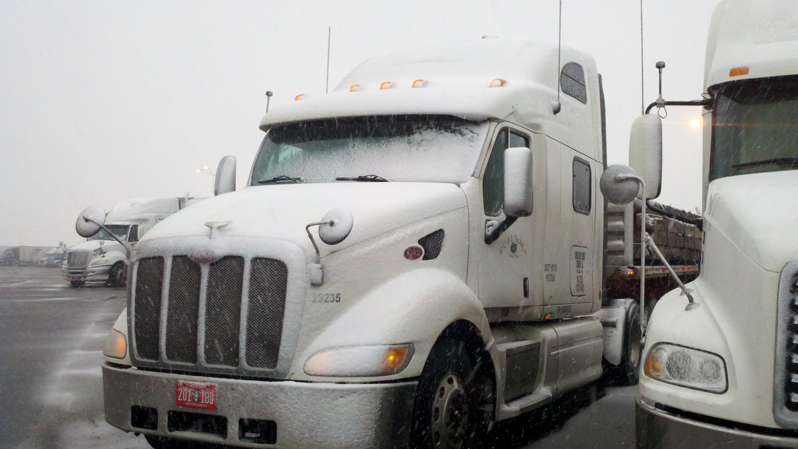
After taking a nap I checked the Wyoming DOT web site an saw that the roads were starting to open back up. I-80 was open for about 100 miles west of me. I decided that I would wait a little longer so I went back to sleep. That felt real good!! Woke up a little later and rechecked the web site. I-80 was open all the way across Wyoming. It was still snowing in Laramie and it was very overcast. I got on the road about 1:15 pm EST. The roads were not read good in Laramie. This is what it looked like:
After a while the roads cleared up but there was the usual Wyoming cross wind of about 30 mph. Drove the 310 miles in Wyoming, then through Utah and into Nevada. Had a brief period of heavy snow for about 5 miles in the Bonneville Salt Flat area but other that that the ride was pretty uneventful. Stopped for the night at the Casinos in West Wendover, Nevada. Had a good meal at the restaurant in the casino. Why is it that there are so many old women using walkers in casinos?
After a while the roads cleared up but there was the usual Wyoming cross wind of about 30 mph. Drove the 310 miles in Wyoming, then through Utah and into Nevada. Had a brief period of heavy snow for about 5 miles in the Bonneville Salt Flat area but other that that the ride was pretty uneventful. Stopped for the night at the Casinos in West Wendover, Nevada. Had a good meal at the restaurant in the casino. Why is it that there are so many old women using walkers in casinos?
Tuesday Morning, February 8, 2011
7:00 MST it is -1 degrees. We didn't get as much snow as expected (so far anyway). Only about 3 inches. I-80 is closed pretty much all the way through Wyoming. So I just have to sit and wait for the road to open.


Monday, February 7, 2011
Monday, February 7, 2011
Started early this morning. Then roads were in pretty good shape until I got on US-87 north of Amarillo. Then they got a bit slick. The road was closed so I had to take a detour. This photo was taken on US-412 / 56 in New Mexico.

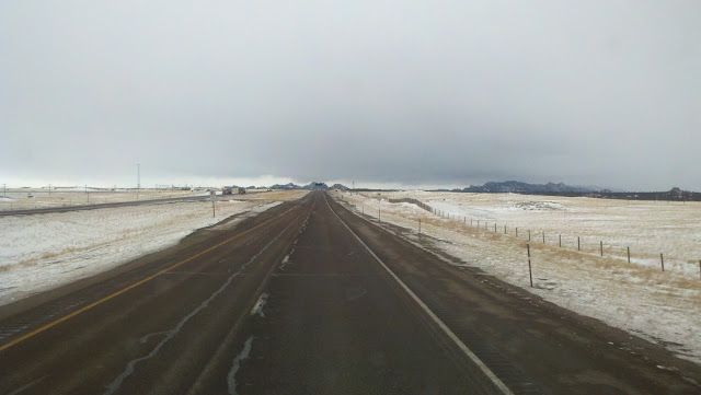
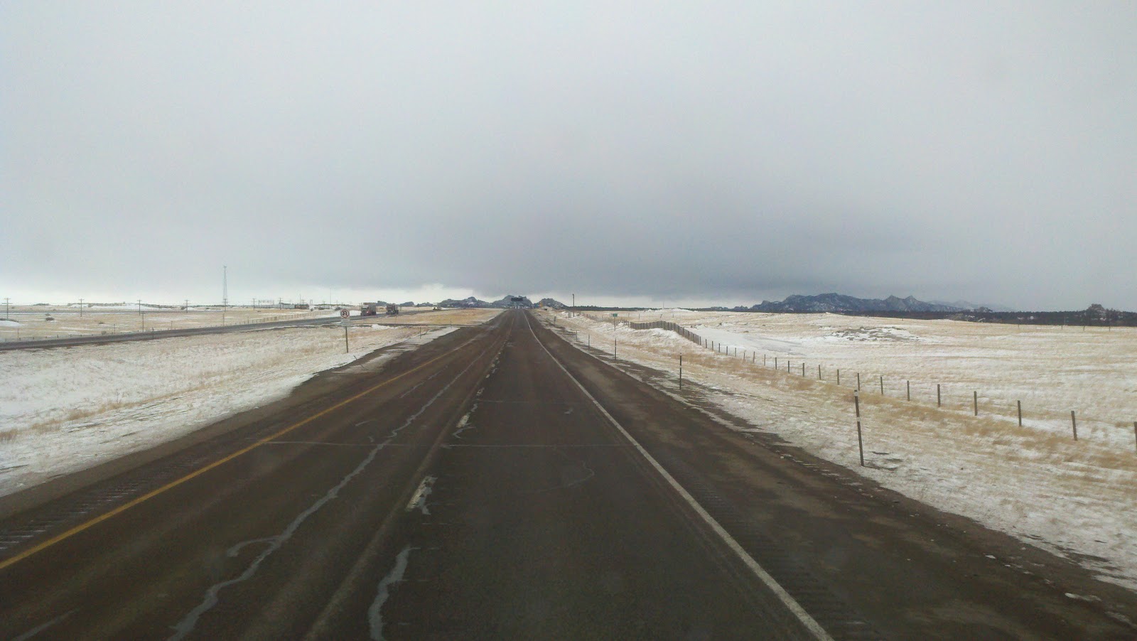
It got a bit better when I finally got to I-25. But then I had to go over the mountain at the New Mexico / Colorado border. This is what it was like going up and down. The photo was taken on the way down in Colorado. Want to give it a try???

The roads improved a lot after I got down the mountain for a little while then the wind picked up. Here is a brief video of I-25 in Southern Colorado:
Drove through Denver again. Here is the Denver skyline.

And another of Mile High Stadium.

As soon as I got in Wyoming the wind picked up. 40+ mile an hour cross wind. At least there was not much blowing snow this time. Then I turned west on I-80. Now the wind was a head wind. Slowed the truck down a lot. Then the sky continued to get dark and then snow flurries.
Stopped for the night at the Petro in Laramie, WY. Checked the National Weather Service web site. Here is part of the advisory for this area:
WINTER STORM WARNING REMAINS IN EFFECT UNTIL 11 AM MST
TUESDAY...
A WINTER STORM WARNING REMAINS IN EFFECT UNTIL 11 AM MST TUESDAY.
* TIMING...SNOW WILL DEVELOP ACROSS THE AREA THIS AFTERNOON AND
WILL INCREASE IN INTENSITY TONIGHT. THE SNOW WILL BE HEAVY AT
TIMES.
* TOTAL SNOW ACCUMULATIONS...TOTAL SNOW ACCUMULATIONS WILL BE
FROM 6 TO 8 INCHES IN THE VALLEYS AND ELEVATIONS BELOW 7500
FEET WITH 12 TO 16 INCHES ABOVE 7500 FEET BY LATE TUESDAY
MORNING. LOCALLY HIGHER AMOUNTS ARE POSSIBLE.
* WINDS/VISIBILITIES...NORTHERLY WINDS WILL BECOME NORTHEASTERLY
AT 15 TO 25 MPH SUSTAINED WITH GUSTS TO 35 MPH. THE WINDS WILL
DECREASE AFTER MIDNIGHT. THE STRONG WINDS WILL PRODUCE AREAS OF
BLOWING AND DRIFTING SNOW LATE THIS AFTERNOON THROUGH THE
EVENING.
I am right about 7,500 feet. It could get very interesting tomorrow. Stay tuned.....
Sunday, February 6, 2011
Sunday, February 6, 2011
Super Bowl Sunday!! Go Packers!! It is snowing hard this morning here in Amarillo, Texas. Glad I'm not in Dallas today because this is heading their way!! Hope it is all gone by tomorrow morning.

Subscribe to:
Posts (Atom)