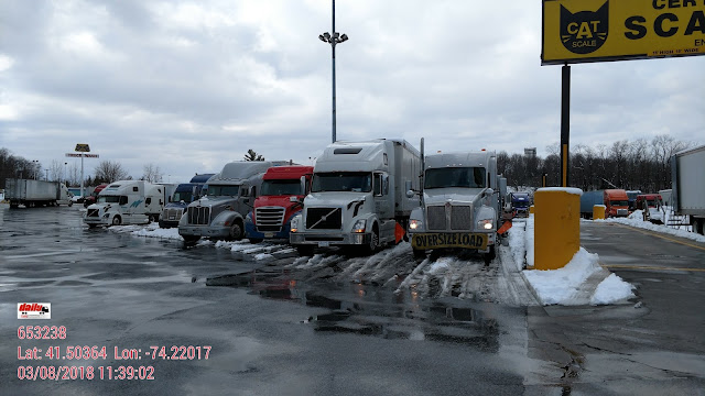
At sunrise this morning we wanted to leave but couldn't. Blocked in by a bunch of trucks parked where they aren't supposed to park.
About a half hour later enough of them had left for us to get out. Drove up to the home office in Carlisle, PA. I made a very unpopular decision not to continue north because of the incoming winter storm.
New York:
Winter Storm Warning
URGENT - WINTER WEATHER MESSAGE
National Weather Service New York NY
342 PM EST Tue Mar 6 2018

NJZ002-004-103-NYZ067>070-071100-
/O.EXT.KOKX.WS.W.0006.180307T0500Z-180308T0900Z/
Western Passaic-Eastern Passaic-Western Bergen-Orange-Putnam-
Rockland-Northern Westchester-
342 PM EST Tue Mar 6 2018

...WINTER STORM WARNING NOW IN EFFECT FROM MIDNIGHT TONIGHT TO
4 AM EST THURSDAY...

* WHAT...Heavy snow expected. Total snow accumulations of 10 to 16
  inches with localized amounts up to 18 inches are expected.

* WHERE...Portions of northeast New Jersey and southeast New
  York.

* WHEN...From midnight tonight to 4 AM EST Thursday. The heaviest
  snow is expected in the afternoon when snowfall rates of 1 to 2
  inches per hour are possible.

* ADDITIONAL DETAILS...Travel will be very difficult to
  impossible, including during the evening commute on Wednesday.
  Travel will also be difficult during the morning commute. Be
  prepared for significant reductions in visibility at times.
  Power outages due to heavy snow weighing down trees or their
  limbs will be possible.
Massachusetts:
Winter Storm Warning
URGENT - WINTER WEATHER MESSAGE
National Weather Service Taunton MA
226 PM EST Tue Mar 6 2018

MAZ002>006-008-009-012-026-070330-
/O.CON.KBOX.WS.W.0006.180307T1200Z-180308T1800Z/
Western Franklin MA-Eastern Franklin MA-Northern Worcester MA-
Central Middlesex MA-Western Essex MA-Western Hampshire MA-
Western Hampden MA-Southern Worcester MA-Northern Middlesex MA-
Including the cities of Charlemont, Greenfield, Orange, Barre,
Fitchburg, Framingham, Lowell, Lawrence, Chesterfield, Blandford,
Milford, Worcester, and Ayer
226 PM EST Tue Mar 6 2018

...WINTER STORM WARNING REMAINS IN EFFECT FROM 7 AM WEDNESDAY TO
1 PM EST THURSDAY...

* WHAT...Heavy snow expected. Total snow accumulations of 12 to 18
  inches are expected.

* WHERE...Much of western and central Massachusetts.

* WHEN...From 7 AM Wednesday to 1 PM EST Thursday.

* ADDITIONAL DETAILS...Travel will be very difficult, if not
  impossible, during the Wednesday afternoon commute. Heavy snow
  falling at the rate of 2 to 3 inches per hour is likely.

PRECAUTIONARY/PREPAREDNESS ACTIONS...

A Winter Storm Warning for snow means severe winter weather
conditions will make travel very hazardous or impossible. If you
must travel, keep an extra flashlight, food and water in your
vehicle in case of an emergency.

I was not willing to take the chance. Not sure how long I'll be here, possibly Monday. Hope not.


